Category: GIS

  • Development, Repair & Retrofitting Solutions for GOLF Course

    Golf Course Engineering Consultancy

    Development, Repair & Retrofitting Solutions

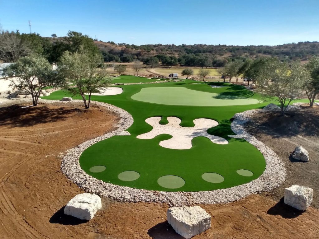
    Golf courses are specialized civil and landscape infrastructures requiring precise engineering, sustainable design, and long-term performance planning. Our engineering consultancy provides end-to-end solutions for golf course development, repair, and retrofitting, combining technical expertise with environmental responsibility and international best practices.


    Our Golf Course Engineering Services

    Golf Course Development

    We provide comprehensive engineering services for new golf course projects, from concept to commissioning.

    Our services include:

    • Site feasibility study and land assessment
    • Topographic survey and contour planning
    • Master planning and course layout engineering
    • Earthwork, grading, and shaping design
    • Surface and subsurface drainage systems
    • Automated irrigation system design
    • Cart paths, bridges, and service infrastructure
    • Turfgrass selection and establishment planning

    Our approach ensures optimal playability, efficient drainage, and long-term durability.


    Golf Course Repair & Rehabilitation

    Existing golf courses often suffer from drainage failure, turf degradation, and aging infrastructure. We specialize in restoring performance while minimizing disruption to operations.

    Key rehabilitation services:

    • Condition assessment of greens, fairways, and bunkers
    • Drainage failure diagnosis and corrective design
    • Re-grading and surface leveling
    • Bunker repair and erosion control
    • Turf restoration and soil improvement
    • Irrigation system repair and optimization

    Golf Course Retrofitting & Modernization

    We upgrade aging golf courses to meet modern standards of sustainability, efficiency, and climate resilience.

    Retrofitting solutions include:

    • Flood mitigation and advanced drainage retrofitting
    • Smart irrigation systems and water-saving technologies
    • Climate-resilient and low-maintenance turf replacement
    • Structural strengthening of cart paths and bridges
    • Water harvesting and reuse systems
    • Sustainable landscaping and naturalization

    Our Engineering Approach

    Integrated Planning

    We combine civil engineering, hydraulic design, landscape planning, and turf science into a single coordinated solution.

    Sustainable Design

    Our designs focus on water conservation, reduced maintenance costs, and environmental compliance.

    Lifecycle Performance

    Every solution is evaluated for long-term durability, operational efficiency, and cost-effectiveness.


    Why Choose Our Consultancy?

    • Specialized golf course engineering expertise
    • International design standards and best practices
    • Customized solutions based on site conditions
    • Strong focus on sustainability and resilience
    • Proven experience in complex outdoor infrastructure

    Technical Capabilities

    • Golf course grading and earthwork design
    • Drainage and stormwater management
    • Irrigation system hydraulic modeling
    • Turf root-zone and soil engineering
    • Erosion control and slope stabilization
    • Construction supervision and quality control

    Industries & Clients We Serve

    • Private and resort golf courses
    • Country clubs and sports authorities
    • Real estate and hospitality developers
    • Government and institutional clients

    Project Delivery & Support

    We support our clients through every stage of the project:

    • Feasibility and concept design
    • Detailed engineering and tender documentation
    • Construction supervision and QA/QC
    • Commissioning and post-project support

    Commitment to Sustainability

    Our golf course engineering solutions promote:

    • Efficient water usage
    • Reduced chemical dependency
    • Climate-adaptive infrastructure
    • Preservation of natural ecosystems

    Contact Us

    Looking to develop, rehabilitate, or modernize a golf course?
    Our engineering team is ready to deliver efficient, sustainable, and high-performance golf course solutions.

    📩 Contact us today to discuss your project requirements.


    SEO Keywords Integrated

    Golf course engineering consultancy, golf course development, golf course construction engineering, golf course repair, golf course retrofitting, golf course drainage design, golf course irrigation system, sustainable golf course design.

  • GIS in Urban Planning: Transforming Real Estate Development in Bangladesh

    Discover how GIS technology is revolutionizing urban planning and real estate development in Bangladesh. Learn about its applications, benefits, and future impact.

    In today’s rapidly urbanizing Bangladesh, efficient land use, infrastructure planning, and sustainable development are more crucial than ever. Enter Geographic Information Systems (GIS) — a powerful tool that’s revolutionizing how we plan cities and develop real estate. From analyzing land suitability to predicting future urban growth, GIS is reshaping the decision-making landscape for architects, engineers, and developers alike. In this post, we explore how GIS is not just supporting urban planning — but fundamentally transforming the real estate sector across the country.

    As Bangladesh experiences rapid urbanization, the pressure on its cities to evolve sustainably and efficiently is intensifying. With increasing demands for housing, infrastructure, and resource management, urban planners and developers are turning to modern technologies to meet these challenges. Among them, Geographic Information Systems (GIS) is emerging as a game-changer.

    GIS enables the visualization, analysis, and interpretation of spatial data to understand relationships, patterns, and trends in geographic contexts. In the realm of urban planning and real estate development, this means better-informed decisions, optimized land use, and more sustainable growth. Let’s dive into how GIS is transforming the urban and real estate landscape in Bangladesh.

    1. Understanding GIS and Its Relevance

    GIS is a framework for gathering, managing, and analyzing data rooted in the science of geography. It integrates many types of data and uses spatial location as its core. By combining maps with descriptive data, GIS provides a powerful tool for understanding and managing urban systems.

    In Bangladesh, where urban growth is often unplanned and chaotic, GIS offers a way to bring order and foresight into development projects. It is particularly useful in real estate, where location-specific insights can significantly impact investment decisions, risk assessment, and strategic planning.


    2. GIS Applications in Urban Planning

    • Land Use Planning: GIS allows planners to visualize current land use patterns and simulate future scenarios. It helps in identifying suitable land for residential, commercial, or industrial development based on various criteria such as topography, accessibility, and zoning regulations.
    • Infrastructure Management: From transportation networks to utilities, GIS helps in designing efficient infrastructure layouts. It enables the analysis of connectivity, capacity, and potential bottlenecks.
    • Disaster Risk Assessment: Bangladesh is prone to natural disasters like floods and cyclones. GIS helps in risk mapping, identifying vulnerable zones, and planning evacuation or mitigation strategies.
    • Environmental Monitoring: With GIS, planners can track changes in land cover, deforestation, or water bodies over time. This is crucial for ensuring that development projects are environmentally sustainable.

    3. GIS in Real Estate Development

    • Site Selection and Analysis: Developers use GIS to evaluate potential sites by overlaying various datasets such as demographics, traffic patterns, nearby amenities, and land prices. This data-driven approach reduces guesswork and increases investment confidence.
    • Market Analysis: GIS can map out trends in property values, rental yields, and housing demand, helping developers understand market dynamics and consumer preferences.
    • Project Planning and Visualization: GIS-based 3D modeling and spatial analysis assist in visualizing projects before construction begins. This improves design accuracy and stakeholder communication.
    • Legal and Regulatory Compliance: GIS helps ensure that projects comply with zoning laws, building codes, and land use regulations, avoiding costly legal issues down the line.

    4. Case Studies and Examples in Bangladesh

    Several urban development projects in Dhaka and Chattogram have already integrated GIS for planning and execution. For example:

    • RAJUK’s Detailed Area Plan (DAP): This major urban planning initiative uses GIS to map and analyze the existing urban fabric of Dhaka and to plan future expansion in a more structured and sustainable way.
    • Smart City Projects: In initiatives like the Smart Comilla and Smart Sylhet projects, GIS is being used for utility mapping, traffic control, and digital infrastructure management.
    • Private Sector Use: Real estate companies and consultancies are increasingly adopting GIS for feasibility studies, client reporting, and land acquisition strategies.

    5. Challenges in Adopting GIS

    • Lack of Awareness: Many stakeholders in the real estate and planning sectors are still unfamiliar with the capabilities of GIS.
    • Data Accessibility: Accurate and up-to-date spatial data can be difficult to obtain, especially from public sources.
    • Skill Gaps: There is a shortage of trained GIS professionals in Bangladesh who can effectively interpret and use GIS data.
    • Cost: GIS software and data acquisition can be expensive for smaller firms or individual developers.

    6. The Future of GIS in Urban Bangladesh

    As Bangladesh moves towards smart city development and e-governance, the role of GIS will become even more central. With increasing investments in digital infrastructure, better data policies, and education, GIS adoption is expected to grow.

    In the future, we can expect:

    • Real-time GIS dashboards for urban management
    • Integration with AI for predictive modeling
    • More public-private partnerships using GIS for housing and infrastructure projects
    • Citizen-facing GIS tools for feedback and transparency

    Conclusion

    GIS is not just a tool—it’s a strategic asset in the mission to develop smarter, more sustainable, and inclusive cities. For Bangladesh, the integration of GIS in urban planning and real estate marks a pivotal step towards better governance, efficient development, and improved quality of life. By overcoming current challenges and embracing its potential, Bangladesh can position itself as a leader in tech-driven urban transformation.

    Whether you’re a developer, policymaker, or urban enthusiast, understanding and leveraging GIS can open up new opportunities and insights in shaping the future of our cities.


    Tags: GIS in Bangladesh, Urban Planning, Real Estate Technology, Smart Cities, Sustainable Development, GIS Tools, Urban Growth, Digital Infrastructure, Bangladesh Development